Six months after launching its Bing search engine, Microsoft has finally added in a lot of the powerful features that most users expected back in June. An expansive upgrade to Bing Maps went live earlier today. In addition, Microsoft has formally announced several other features that have quietly been live for awhile.
The Bing Blog has a long post that walks through the features Microsoft formally announced and demoed at a press conference in San Francisco this morning. (Great trivia from the post: The most common decision people try to make using Bing is what to wear based on the weather.) Here’s a rundown of the major upgrades:
- Entity cards for people, places and things. These are index card-like summaries of info about a person, place or thing, always with a thumbnail photo or image. The cards are served as the primary result for many searches now, pushing the traditional “ten blue links” list of ranked web pages aside to deliver quick-reference facts. For example, see the result for the University of Maine shown below. Bing team members told journalists this morning that the content on the cards is composed of what they found most people are looking for when they search. It’s a big shift away from providing links to web pages as results. Google shows you where to get the answer. Bing gives you the answer.
- Mobile phone results focused on one likely answer. On Bing’s mobile site, m.bing.com, results are even more driven toward one answer instead of a list. Bing assumes the mobile search user is most likely seeking directions and/or contact info. I don’t have a screen shot of the mobile UI, but it features a prominent ‘Directions’ button.
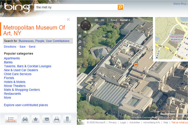
- Greatly enhanced Bing Maps. There are several new features. Bing Maps now makes heavy use of Microsoft’s Flash-like Silverlight player, rather than web standard Ajax, to perform visual tricks not possible with Ajax. It also uses Microsoft’s Photosynth technology to create 3-D landscapes of buildings and hills from 2-D photographs. Bing Maps can morph seamlessly between different views that come from different sets of data, rather than clearing the screen and repainting it as Google Maps does. There’s also a Streetside feature that’s much like Google’s Street View. Finally, location-based mashups are possible. Bing automatically includes, for example, Twitter Maps, which display fresh tweets pinned to the map locations of the people who tweeted them.
- Facebook and Twitter integration. Microsoft demoed a not-live-yet Bing search of a user’s Facebook info that was more visual and less intractable than Facebook’s UI. For example, a clickable grid composed of friends’ faces made it easy to see their fresh updates. Bing also provides visual pages that show several different rankings of top Twitter users. The Twitter searches were restricted to the main public stream, rather than searching the user’s followees.
Here are some screen shots of Bing Maps and a typical result card:
VentureBeat's mission is to be a digital town square for technical decision-makers to gain knowledge about transformative enterprise technology and transact. Learn More


