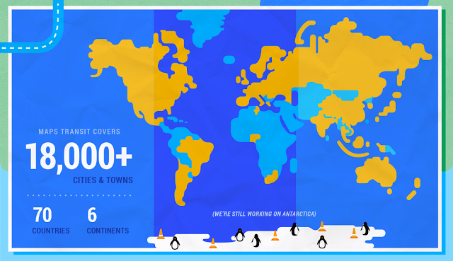
Google Maps has provided public transit information since 2007, but today it’s enhancing the service by adding real-time public transit arrival times.
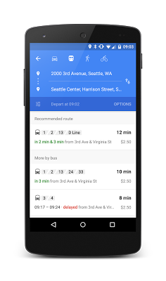
The app will provide live arrivals for local buses, metro lines, and subway systems. It also provides alerts for canceled routes.
The feature is rolling out in three U.S. cities — Chicago, San Francisco, and Seattle — and in a couple of new countries — the U.K. and the Netherlands. Budapest gets it, too.
The app arranges and summarizes your transit options at the top of the screen so it’s easy to know at a glance how long you’ll be waiting. It also gives you other options in case you miss the bus or train you wanted.
Google says it’s working with more than 100 public transit agencies to provide real-time transit information. It added 25 new agencies with the addition of the new cities and countries.
VentureBeat's mission is to be a digital town square for technical decision-makers to gain knowledge about transformative enterprise technology and transact. Learn More


