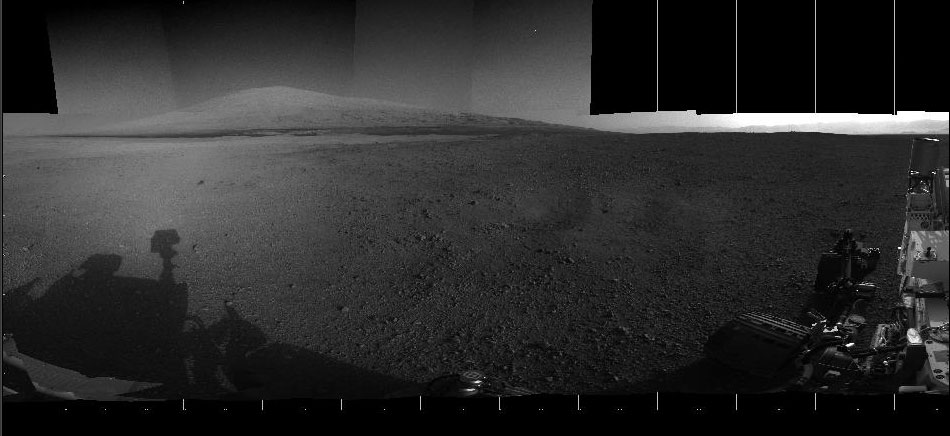
Now that the Curiosity rover’s cameras are open and fully operational, it’s sending back gorgeous and fascinating shots like the one above, a 360-degree panorama showing the rollerbot as it approaches Mars‘s Mt. Sharp.
[aditude-amp id="flyingcarpet" targeting='{"env":"staging","page_type":"article","post_id":514401,"post_type":"story","post_chan":"none","tags":null,"ai":false,"category":"none","all_categories":"business,","session":"C"}']“With the addition of four high-resolution Navigation Camera, or Navcam, images, taken on Aug. 18 (Sol 12), Curiosity’s 360-degree landing-site panorama now includes the highest point on Mount Sharp visible from the rover,” reads NASA’s update on the image.
Mt. Sharp is the rover’s destination — rather, geological deposits around the mountain’s base, to be precise. The mountain towers 3.4 miles above Gale Crater, where the Curiosity rover first landed two weeks ago.
AI Weekly
The must-read newsletter for AI and Big Data industry written by Khari Johnson, Kyle Wiggers, and Seth Colaner.
Included with VentureBeat Insider and VentureBeat VIP memberships.
The panorama is a stitched-up mosaic of 26 Navcam images taken in the wee hours of August 7/August 8, plus four new images taken on the 18th.
Also, we’ve got this new video showing Curiosity’s landing in glorious high-resolution. We’ve seen the landing before, but only through low-res cameras in a grainy stop-motion-style video clip.
Last week, we also got to see an interactive 360-degree panorama of the Martian landscape created by photographer Andrew Bodrov. Today’s image, however, is the first time we’re seeing Mt. Sharp through Curosity’s eyes.
The goal of the Curiosity mission is to gather and analyze the Mt. Sharp geological deposits for “organic compounds and environmental conditions that could have supported microbial life now or in the past.”
VentureBeat's mission is to be a digital town square for technical decision-makers to gain knowledge about transformative enterprise technology and transact. Learn More