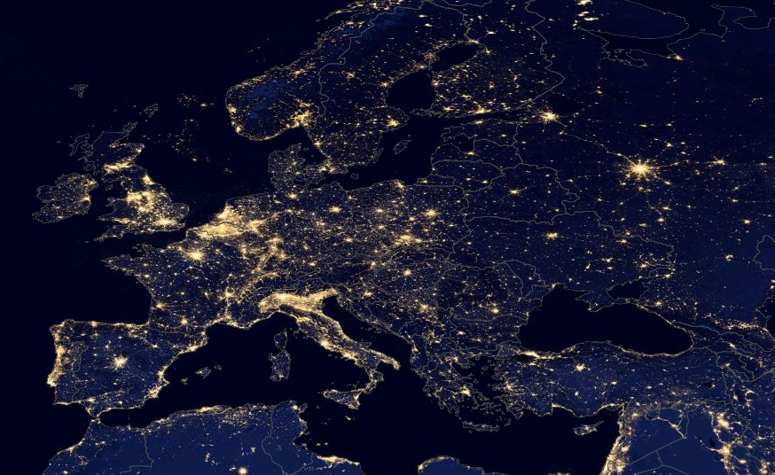
Recently, a series of “black marble” images from NASA showing the lights of Earth glowing into space made the rounds on the web. Apparently, the images were so popular that NASA has decided to up the ante with a dose of interactivity.
[aditude-amp id="flyingcarpet" targeting='{"env":"staging","page_type":"article","post_id":587123,"post_type":"story","post_chan":"none","tags":null,"ai":false,"category":"none","all_categories":"offbeat,","session":"C"}']NASA has just highlighted a fascinating application that lets you see the nighttime lights and geographical boundaries of our home planet. Called Worldview, the app is basically a souped-up Google Maps overlaid with layers to show NASA’s homebrewed data, from night lights to clouds, dust, volcanoes, cyclones, and floods. The data visualization can even show the presence of certain molecules like carbon monoxide and sulfur dioxide.
Cooler still, you can shift the timeline to see lights and flooding on the Eastern seaboard during Hurricane Sandy, for example.
AI Weekly
The must-read newsletter for AI and Big Data industry written by Khari Johnson, Kyle Wiggers, and Seth Colaner.
Included with VentureBeat Insider and VentureBeat VIP memberships.
The whole shebang comes from NASA’s Earth Observing System (EOS) and is powered by the agency’s Land Atmosphere Near Real-Time Capability for EOS (LANCE). In short, it pulls together massive amounts of data about our planet — and really fresh data, too. From the WorldView app’s info page:
This new tool from NASA’s EOSDIS provides the capability to interactively browse full-resolution, global, near real-time satellite imagery from 50+ data products from LANCE. In essence, this shows the entire Earth as it looks “right now” — or at least as it has looked within the past few hours. This supports time-critical application areas such as wildfire management, air quality measurements, and weather forecasting. The data is generally available within three hours of observation and can be compared to observations since May 2012…
Worldview uses the newly-developed Global Image Browse Services (GIBS) to rapidly retrieve its full-resolution imagery to provide an interactive browsing experience. While Worldview uses OpenLayers as its mapping library, GIBS also supports Google Earth, NASA World Wind, and several other clients. We encourage interested developers to build their own clients or integrate NASA imagery into their existing ones using these services.
For tablet browsing, NASA recommends using an iPad 2 or better. Worldview is still in its alpha release, so complain with caution.
VentureBeat's mission is to be a digital town square for technical decision-makers to gain knowledge about transformative enterprise technology and transact. Learn More