You can now create your very own Street-view experiences, using little more than some patience, an Android phone, or a DSLR. Google has announced a new feature for Google Maps that lets anyone convert 360-degree images into street view-esque guided tours that can be plotted on Google Maps and shared with the world.
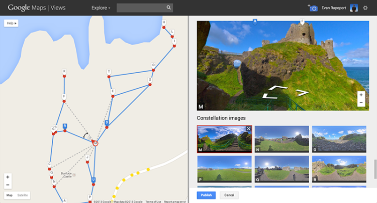
Getting started is simple, provided you have an Android phone running Android 4.2 or higher: Fire up the camera app and use the photo sphere function to take a 360-degree shot of your current location. You’ll then use Android’s sharing functionality to send the image over to Google Maps’ Views. Here’s where things get interesting: The new update lets you stitch several of these photo spheres into “constellations.” The functionality relies on the GPS data attached to every image, though you’ll be able to shuffle pins around on Google Maps.
Alas, my tiny San Francisco apartment doesn’t make for much of a guided tour; this’ll likely be of more use to folks who want to map out a favorite hiking trail or perhaps show off the holiday decorations that are already springing up in their neighborhood. Constellations don’t replace existing Google street view images, so you could also potentially map the same location over the course of a year and show off dramatic changes with time and weather. These images can also be kept private, if you’d rather keep the hoi polloi in the dark about how awesome your office is.
If you don’t own an Android device, you can still upload images to Google Maps and add location and metadata manually — there are plenty of Help Pages to guide you through the process.